(The following piece ran in the November/December 2015 issue of CoolTears. There are cutlines, a bibliography and other material included here that the editor chose not to run).
Alaska Calling: Getting There
By Ed Sasser
"You sure are a long way from home."
"Did you tow that thing all the way from Alaska to New Mexico?"
"We've always dreamt of driving the Alaska Highway."
An Alaska license plate invites comment; no doubt about that. And those of us towing teardrops are well aware of the curiosity our little trailers spark in passers by. Combining the two factors, we've lost track of the number of impromptu "tours" we've given in our first 11,000 miles. Many included questions about the "ultimate" teardrop trip: Alaska.
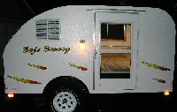
Folks contemplating travel into Alaska seem to be seeking first-hand knowledge, reassurance as to its actual possibility and, maybe, a little encouragement. While we may refer to the route as our "commute," we've taken every quest quite seriously. What follows is a summary of the most frequent fire-side chats Natalie and have had with fellow teardroppers about traveling north. Pictures are from a June 2015 return home from the "outside" that we made with grandson, Edwin, in our 5 X 10 homebuilt, The Coot.
The fat guide
My first recommendation to anyone contemplating a run north is to pick up the latest edition of the Milepost: a fat, mile by mile (km by km) guide from several lower 48 ports of entry to multiple Alaska destinations. Every named highway in Alaska, British Columbia and the Yukon is detailed along with Alaska Marine Highway info and route-planning ideas. Ya gotta have one. No campfire conversation is going to replace having a copy of this book on the dashboard.
Alaska or Cassiar?
Since our most recent trip originated in Las Vegas and ended in Skagway, the Alaska Highway was the most practical for us. As the return would take us through Seattle, the Cassiar would be about 200 miles shorter.
Choice of route will depend on personal preferences around history, infrastructure, time allotted and other factors. Obviously if you are a student of the WW II operating engineers who braved the fierce northern environment to link Alaska to the outside, you may elect the Alaska Highway. I've included a short bibliography to give you a head start. If, on the other hand, you want to stay west of the continental divide or experience a quaint little coastal village like Hyder, Alaska, the Cassiar may be better for you.
Some folks elect to ride the Alaska Marine Highway one or both ways. (See Cooltears April 2013 for a description of ferrying both north and south). We frequently ride the "Blue Canoe" as the system vessels are affectionately known. They are especially helpful when we want to go south in the winter and camping the Highways would be
impractical. On these seasonal runs the driver has traditionally gone free with purchase of a vehicle ticket.
Pace and Timing
Whatever time you have allotted as realistic, it's usually pretty safe to double it and add some. Unless you are just delivering a trailer to Alaska, you will find yourself craving "lay-over days" in multiple spots. This might include hot springs, river crossings, or historic lodges with wifi and home-made pie. Toad River, as an example, is one of my favorites. You may also find yourself captivated, or held captive by animals on the roadway, stunning vistas, construction or forest fires. Schedule slush might be allowed for such things as personal injuries or flying in the right part.
For these and many other reasons, it would be rare for us to pre-book camp sights. If the highway starts looking full, we stop early and claim a spot.
Depending on which approach you utilize to get to "mile zero" at Dawson Creek, you may prefer varying the pace. For instance, crossing Saskatchewan may average more miles per day than the Ice Field's Highway with its many photo ops and camping sites.
As far as time of year, we often depart Alaska in late September/early October. We carry traction devices and usually hit snow at some point. The same is true for April-May returns. Fair weather travel might include a piece of mosquito netting big enough to cover your entire vehicle or the galley area of the 'drop. Winter would be insane. I've driven chunks of it then but I was on a payroll.
Canadian Customs
This is an entire treatise on its own and I won't play the authority. Make sure you consider your cell phone charges, ID issues, permission letters for grandchildren, credit card notifications, firearms, insurance and medical needs. I like to carry massive amounts of cash but not over $10,000 per person; I don't want the additional declaration paperwork at the borders. Depending on your route, you could have multiple crossings, especially if you take side trips into Hyder or Skagway.
Road Conditions
This is a classic "Blue Highway" tour with no freeway option. Conditions are variable depending on the highway. Map legends clearly outline surface materials and are mostly accurate. Construction delays are always possible and the average speed indicated on GPS mapping systems is purely a mathematical function.
Frost heaves are indicated with little red or orange flags next to the highway. Slow down ahead of time for these unless you want to snap a pic of the daylight under your trailer tires in the rear-view mirror. This is where you will be happy to have a single axle vs a triple-axle fifth wheel. Almost all of the primary highways are paved although center and fog lines shouldn't be expected. I don't run at night except for emergencies or when somebody pays me. If you plan to, get moose lights.
Fuel
Top off frequently and carry a jerry. Know your vehicle range and have an advance idea of the next few fuel stops. Check the Milepost for hours of operation and possible closures. Don't assume. Last time I went through Border Town he closed at something like 7pm and didn't take credit cards. The gamble to make Northway to an all-nite self serve paid off but reminded me why I had a list of personal fuel rules. Things change between trips. Resolve doubt in your favor.
To calculate current U.S. per gallon price from Canadian price per liter, multiply per liter price (Canadian) by 3.785 and divide by current exchange rate (U.S. to Canadian). Highest price I've run into on the past few trips is $7.20 a gallon--Muncho Lake. Pat myself on the back for storing the motor home in Vegas.
Mindful Travel
What Captain Obvious may be missing when he tells us we're a long way from home is our belief that the teardrop lifestyle allows us to feel as if we ARE home.
For best results, consider adopting an aphorism or theme for your trip. It's going to be a long one. It's going to be epic.
Examples from some of our prior runs have included:
"Measure me not by how grand I am but by how far I have come." (This, in fact, is our teardrop ethic.)
"Stay low and zigzag tour--2011"
"Douglas Island, Alaska
adult hide and seek league
2012 champions"
"Somebody left the gate open."
"Just passin' thru."
"70 degree isotherm meander"
From 1979: "The last, great, V8, trans-Alaska Trek." (And it was.)
...and a personal favorite:
"Arrival is an illusion; destination and journey are one."
What works for you to slow down, de-stress, be in the moment and remind yourself that it's not worth sweating the small stuff and it's all small stuff? This is the journey of a lifetime with people you love. Be there!
Teardropping: a fast way to slow down.
-30-
Photos/ cutlines sent to CoolTears: magazine didn't run the cutlines.
Check your wheel bearings before you start and carry spares of critical components. This is a wide spot on the Yukon-BC border.
Grandson Edwin explores Watson Lake's famous Sign Post Forest. Bring something from home to add to the collection. There is also a visitor's center here and, as with most of them, they have WiFi.
Any time two teardrops find each other on the highway it's a "gathering". This one was just south of Dawson Creek. Natalie stands next to The Coot, the teardrop on the right.
Ed at the top of the Cassiar, where it joins the Alaska Highway. There is a similar sign (that reads NORTH) at the bottom where the Cassiar meets Canada Rt 16. In between is access to a small part of the Alaska Panhandle, Hyder.
"Mile Zero" is a mandatory stop. There is a lot of Canada to drive through before you get there.
A lay-over day in Toad River means Natalie bakes a fresh batch of highway cookies. A beaver dam and lodge are in the background.
If your plan does not include a trip north to Fairbanks or Anchorage, you can cross the Klondike Highway into Skagway. This is a good way to go if you want to drive one way and ferry the other. The Alaska Marine Highway operates boats from Skagway to Bellingham, Wa thru the inside passage.
Besides spare parts, we like having mosquito netting, four ways to cook and our folding bicycles.
Check them out:
-MILEPOST 2015 Edition (a must)
-The Black Soldiers Who Built the Alaska Highway: A History of Four U.S. Army Regiments in the North, 1942-1943 by John Virtue
-Lunch at Toad River by Sally Lesh
-Tales of a Catskinner by Chester Russell
There are many others; these will get the juices flowing.
3-sentence Bio
Ed Sasser is a dedicated teardrop trailer camper and boatbuilder. He has written hundreds of articles for outdoor, military and boating magazines and newspapers. He lives on Douglas Island, Alaska with his spouse of 43 years and travels the desert southwest much of the winter.
Cover photo by Diana Sloan. All photos at cooltears.com
Teardrops n Tiny Travel Trailersor t n ttt for short (tnttt.com) |
Up the Alcan/Down the Cassiar
1 post
• Page 1 of 1
Up the Alcan/Down the Cassiar
![]() by TheCoot5X10 » Fri Jan 22, 2016 12:11 am
by TheCoot5X10 » Fri Jan 22, 2016 12:11 am
- TheCoot5X10
- Teardrop Inspector
- Posts: 1
- Joined: Mon Sep 07, 2015 10:59 am
1 post
• Page 1 of 1
Who is online
Users browsing this forum: No registered users and 3 guests