Unique hobby!

Things that don't fit anywhere else...

Postby southpennrailroad » Thu Jan 06, 2011 10:55 pm

Image

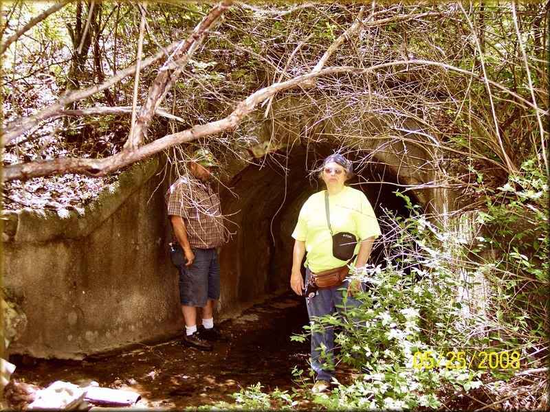
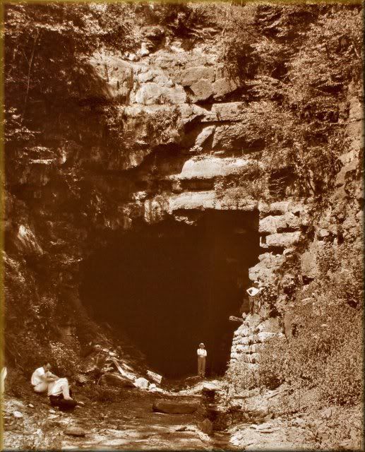
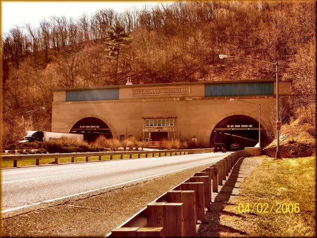
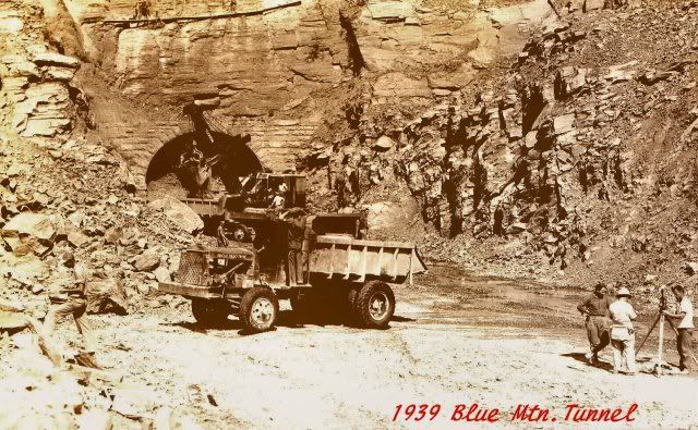
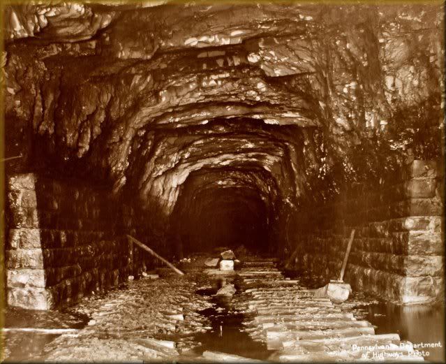
One of our Pennsylvania Turnpike tunnels which originally was suppose to be a railroad tunnel near Harrisburg. The far tunnel was the railroad tunnel never completed and sat for 50 years B4 the turnpike came along and used it as the first super highway in America.

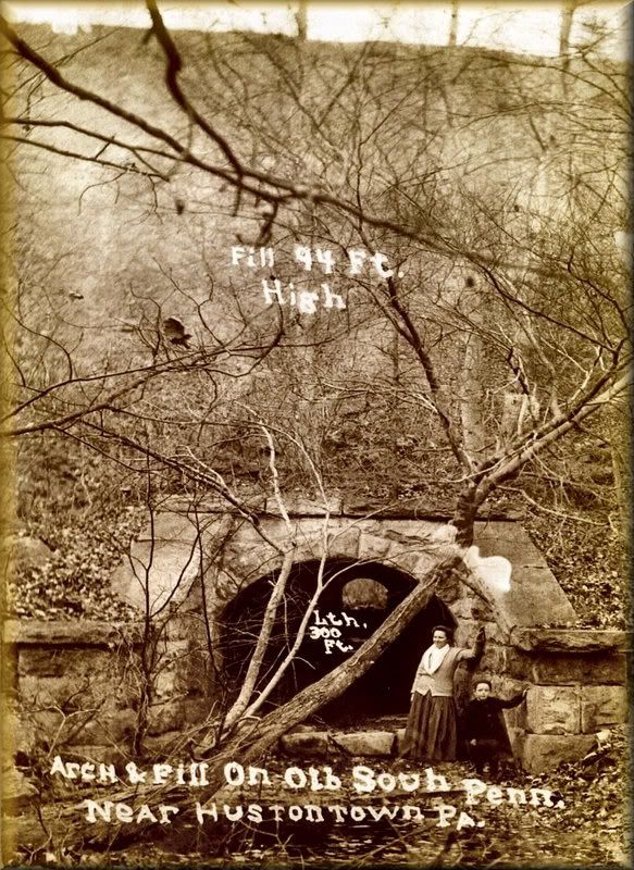
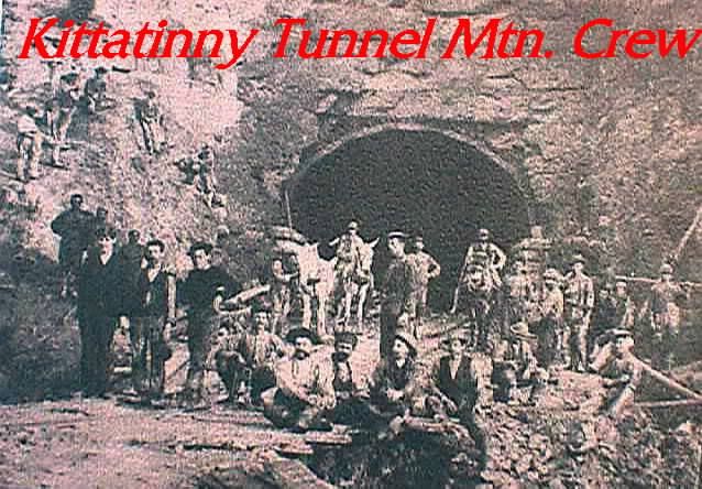
The square stones in the foreground have been laying here since 1883-1885 when the railroad was cutting them to build their tunnel now used as a turnpike tunnel.

Image

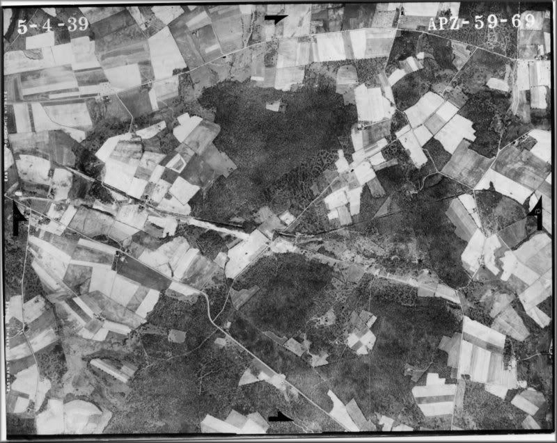
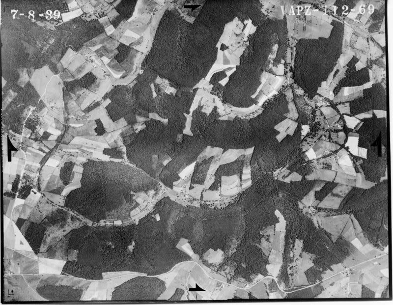
In a different part of the route shows the route 219 north of Somerset cutting across the old railroad right of way. (look at the other side in the center of this photo to see the silhouette of the railroad grade. The day had to be just right to get this shot.

Image

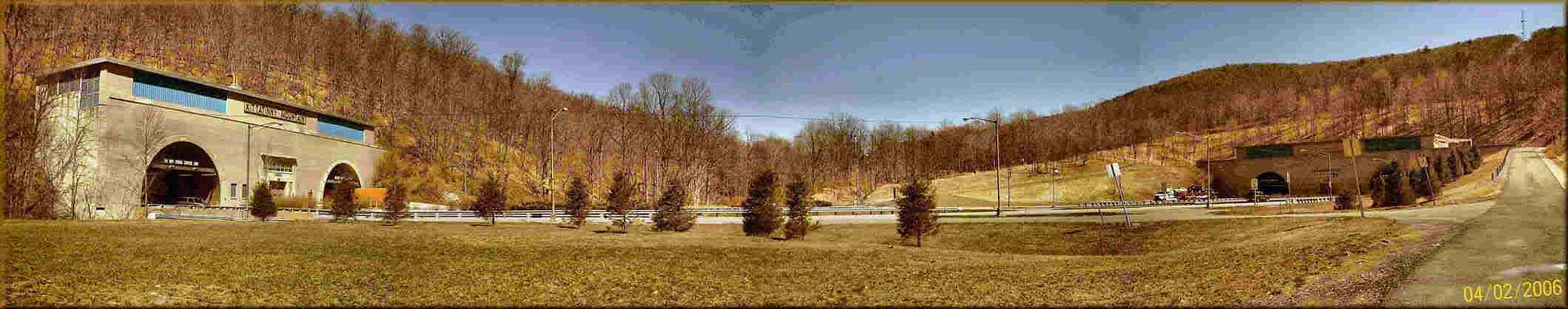
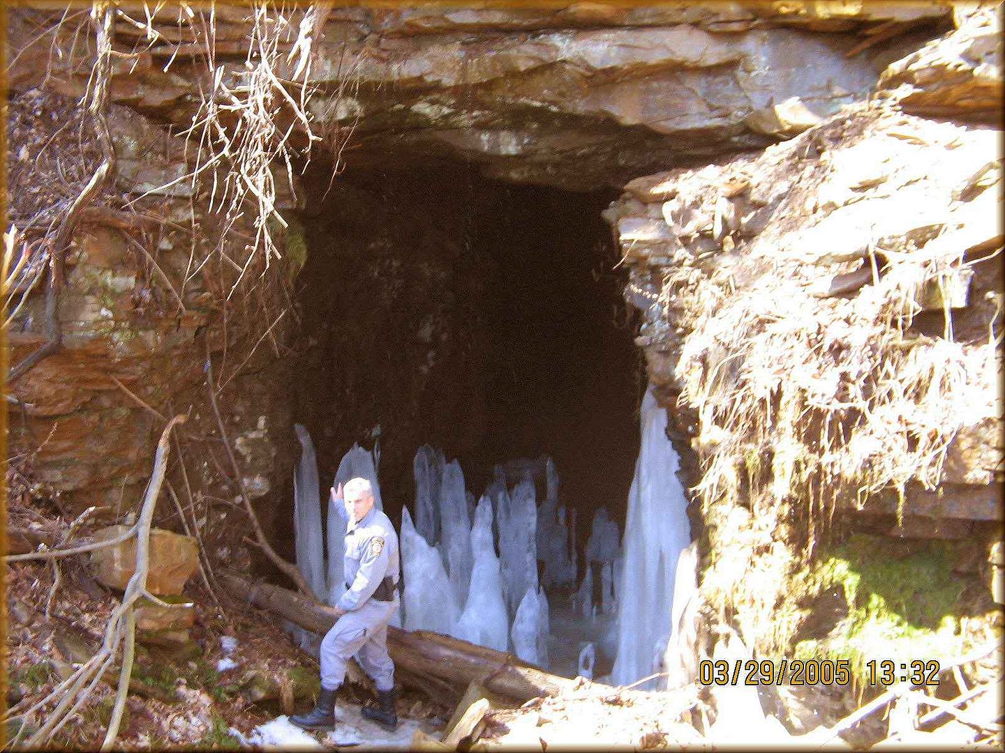
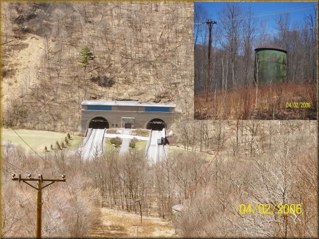
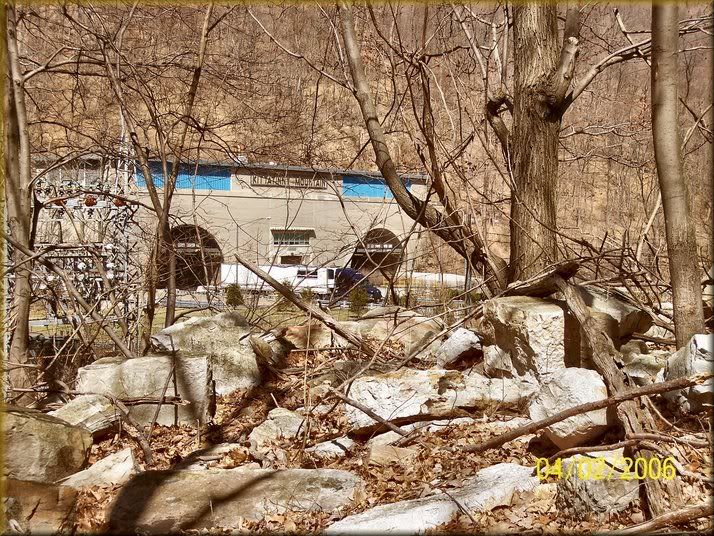
Above. this is the valley seen in the previous photo above. The double mountain makes it hard for snakes to wonder out of this valley. Workers at the tunnels say that the snakes love the warm stair wells so it isn't uncommon to find them at the tunnels when they come to work. Also in the previous photo, I had gotten there a week late as one of the workers explained that the lights and power grid short circuited once or twice as upon investigating when this happens is to check to see if a rattle snake isn't fried atop the power lines in the enclosed power step down station off to the left. .
Long time researching the abandoned South Pennsylvania Railroad along the Pennsylvania Turnpike. God will guide me. As he has done so in the past. southpennrailroad.com
User avatar
southpennrailroad
500 Club
 
Posts: 864
Images: 0
Joined: Sun Nov 27, 2005 8:05 pm
Location: Monroeville, Pennsylvania

Postby southpennrailroad » Thu Jan 06, 2011 11:11 pm

Image

A state Police officer poses in front of one of the original railroad tunnels on the Allegheny Mountain east of Somerset, Pa. The turnpike felt this tunnel was unsafe to use so they built their own about 85 feet to the left of this tunnel once again abandoning the railroad work. He became a good friend. 18 years working this area and never knew this old tunnel was only 85 feet away from him. Most of these workers know me and are always glad to see me when I show up.
Long time researching the abandoned South Pennsylvania Railroad along the Pennsylvania Turnpike. God will guide me. As he has done so in the past. southpennrailroad.com
User avatar
southpennrailroad
500 Club
 
Posts: 864
Images: 0
Joined: Sun Nov 27, 2005 8:05 pm
Location: Monroeville, Pennsylvania

Postby southpennrailroad » Thu Jan 06, 2011 11:25 pm

By the way I do all the photographing myself including standing at the archives in Harrisburg from 0900 -1600 two days in a row usually photographing letters from that railroad to take home and read and find new things as to what was going on while the surveys took place as well as the construction phase. beside trying to live in my trailer as some of you have helped, I live for this hobby.

I have thousands of documents showing the route, maps and aerial shots showing what or where it is. The turnpike though they purchased it they did not use but barely little of it.

I did mention it on a small occasion but thought because you are mostly from outside this area that you weren't much interested. I guess I finally hit the right nerve.

Thanks

Oh sorry about the size I know the rules but with so much (thousands of photos) I don't have the time to re size.

Image

This shows an abandoned section of the Pennsylvania Turnpike just east of Breezewood in the mountains that shows the railroad grade (I am standing on) un used by the Pennsylvania turnpike owner still leading to reach the tunnel started by them and completed by the turnpike from 1940-1968.
Long time researching the abandoned South Pennsylvania Railroad along the Pennsylvania Turnpike. God will guide me. As he has done so in the past. southpennrailroad.com
User avatar
southpennrailroad
500 Club
 
Posts: 864
Images: 0
Joined: Sun Nov 27, 2005 8:05 pm
Location: Monroeville, Pennsylvania
Top

Postby southpennrailroad » Thu Jan 06, 2011 11:32 pm

Here is the last of what I have for tonight

Image

A copy of the grade on the east slope of the Allegheny Mountain. All made in 1881-1883 and shows the topographic contour lines of the valleys along the railroad route never used but completed in different stages of construction. yes I have walked the whole route here as well as other parts of the state.

REMEMBER NEVER COMPLETED WHICH MEANS NEVER USED OR OPERATED.
Long time researching the abandoned South Pennsylvania Railroad along the Pennsylvania Turnpike. God will guide me. As he has done so in the past. southpennrailroad.com
User avatar
southpennrailroad
500 Club
 
Posts: 864
Images: 0
Joined: Sun Nov 27, 2005 8:05 pm
Location: Monroeville, Pennsylvania
Top

Postby southpennrailroad » Thu Jan 06, 2011 11:44 pm

Image

Here are some of the maps. I have all of them showing the route from Harrisburg to Pittsburgh.

Did you ever run away from Home?

I did and on one occasion (I sometimes start a show presentation using this.) I was 16 soon to be 17 and doing this on my bike. With very little cloths, and my favorite collection of 45 records placed through my handle bars. (You that are old know like me know what those are right?) Well I went off riding down busy route 65 north at night and headed to California. (I have no idea why I choose that destination) Well I made it all right into Ohio just across the boarder from my home state of Pennsylvania when I stopped to look at my map. Dang I went the wrong way would you know and what made it worse was that I was stopped just inside a bank parking lot lit up and while I was just folding up the map when a police car shows up. Well after some words he hauls my bike to a nearby bar and takes me to the police station some miles away. I get locked up for a few hours until my parents show up. I thought my father was going to kill me. I was amazed though I never got touched.

You know what I learned from that ordeal? I learned how too read a map. And have been doing that ever since. I think that is one of the reasons I love GPS as well. I do tell people that I don't get lost because of that lesson.

Well not quit. I wasn't running away from home on this one instance but I have to say with all honesty that I got turned around when the day after I got married my wife and I left home early in the morning to head for the Poconos on our honeymoon. I was getting sleepy and pulled over to snooze a little. Well after bit of a nap, I headed back out onto the interstate and was feeling cheerful that we were on our way again. Well I noticed it but rejected the idea that I was actually doing something stupid until my wife said Russ didn't we see that on the way earlier before we pulled off the highway and wasn't it on the other side of the highway. Nahh couldn't be I wouldn't have done that. There must be another one just like it. Then I saw what read was an I-80 West sign. I was suppose to be traveling east. Again I said no someone just was playing games and moved a west bound interstate highway shield sign up on the east bound lanes. Then I had to come to my senses that I really was indeed traveling back home.
Long time researching the abandoned South Pennsylvania Railroad along the Pennsylvania Turnpike. God will guide me. As he has done so in the past. southpennrailroad.com
User avatar
southpennrailroad
500 Club
 
Posts: 864
Images: 0
Joined: Sun Nov 27, 2005 8:05 pm
Location: Monroeville, Pennsylvania
Top

Postby southpennrailroad » Fri Jan 07, 2011 6:19 am

Image

These two photos are beneath the Pennsylvania Turnpike just west of the Fort Littleton area. The structure was enlarged to accomadate the south or east bound lanes.

Image

Notice how the railroad culvert builders lined the creek bed with deep stone for erosion purpose. Also in the shot below the ring stones on the arch.

This was taken circa 1930. Built by the railroad expanded by the turnpike. It is strange for them to have said it was a modern highway in 1940 when it opened up but built on a 50 year old railroad bed.

Image

Inside view showing the expansion joint Old railroad stone work on the right turnpike expansion on the left.

Image

The view looking west atop the stone culvert or railroad grade.
Last edited by southpennrailroad on Fri Jan 07, 2011 6:52 am, edited 1 time in total.
Long time researching the abandoned South Pennsylvania Railroad along the Pennsylvania Turnpike. God will guide me. As he has done so in the past. southpennrailroad.com
User avatar
southpennrailroad
500 Club
 
Posts: 864
Images: 0
Joined: Sun Nov 27, 2005 8:05 pm
Location: Monroeville, Pennsylvania
Top

Postby southpennrailroad » Fri Jan 07, 2011 6:30 am

Image

Another tool is this aerial 1939 photo showing the Pennsylvania Turnpike being built along side (south) another tunnel that the turnpike opted to bypass. Yes I did go into this tunnel to photograph it. Look close in the center to see where the tunnel is right next to the turnpike.

Image

This 1939 aerial goes with the one previous map above. This is all still laying in the woods today.

Image

Here is a partially built railroad tunnel that is today the Pennsylvania Turnpike. It is the only tunnel with a creek running directly in front of it so this is easy to know where it is found today.

This is the same tunnel with the bridge. Could say 1935 THEN


Image

Now Notice the bridge

But then again 120 years ago view of the railroad tunnel crews posing for a photo sot.

Image

I suppose it is a rare thing to get a shot of the same spot taken years apart. But I love to stand in the same spot as a previous photographer to get the same then and now shots. But to get three different era type shots could be unique.
Long time researching the abandoned South Pennsylvania Railroad along the Pennsylvania Turnpike. God will guide me. As he has done so in the past. southpennrailroad.com
User avatar
southpennrailroad
500 Club
 
Posts: 864
Images: 0
Joined: Sun Nov 27, 2005 8:05 pm
Location: Monroeville, Pennsylvania
Top

Postby southpennrailroad » Fri Jan 07, 2011 5:41 pm

Image

Transition. This photo shows the east portal of the now west bound tunnel lanes of the Blue Mountain Turnpike Tunnel started by the railroad abandoned this way for fifty years when bought by the newly formed Pennsylvania Turnpike. Here the contractors are tearing down the railroad facade to enlarge it to conform to their standards. If traveling from east to west you enter this as the first of nine railroad tunnels 26 miles west of Harrisburg. MP 197.0

I try to be more precise so they are actually lowering the road bed so this actually is the ventilation shaft for the turnpike tunnel.
Long time researching the abandoned South Pennsylvania Railroad along the Pennsylvania Turnpike. God will guide me. As he has done so in the past. southpennrailroad.com
User avatar
southpennrailroad
500 Club
 
Posts: 864
Images: 0
Joined: Sun Nov 27, 2005 8:05 pm
Location: Monroeville, Pennsylvania
Top

Postby southpennrailroad » Fri Jan 07, 2011 5:54 pm

From this abandoned railroad right of way in 1935

Image

To this taken by me in 2006

Image
Long time researching the abandoned South Pennsylvania Railroad along the Pennsylvania Turnpike. God will guide me. As he has done so in the past. southpennrailroad.com
User avatar
southpennrailroad
500 Club
 
Posts: 864
Images: 0
Joined: Sun Nov 27, 2005 8:05 pm
Location: Monroeville, Pennsylvania
Top

Postby southpennrailroad » Fri Jan 07, 2011 6:16 pm

What the turnpike contractors saw inside the tunnels

Image
Long time researching the abandoned South Pennsylvania Railroad along the Pennsylvania Turnpike. God will guide me. As he has done so in the past. southpennrailroad.com
User avatar
southpennrailroad
500 Club
 
Posts: 864
Images: 0
Joined: Sun Nov 27, 2005 8:05 pm
Location: Monroeville, Pennsylvania
Top

Postby southpennrailroad » Fri Jan 07, 2011 6:30 pm

Image

Uploaded with ImageShack.us


In areas where the railroad was not built such as the beginning of this topic, I had to study the actual railroad maps (inserted on this aerial photo and looking for natural landmarks such as this property lines that have not changed since the 1881-1885 survey era of the railroad. I used orange to mark what is on the survey maps to that of the aerial photos.
Long time researching the abandoned South Pennsylvania Railroad along the Pennsylvania Turnpike. God will guide me. As he has done so in the past. southpennrailroad.com
User avatar
southpennrailroad
500 Club
 
Posts: 864
Images: 0
Joined: Sun Nov 27, 2005 8:05 pm
Location: Monroeville, Pennsylvania
Top

Postby southpennrailroad » Fri Jan 07, 2011 6:50 pm

Image

Uploaded with ImageShack.us

This one is showing the intersection seen below

Image

Uploaded with ImageShack.us
Long time researching the abandoned South Pennsylvania Railroad along the Pennsylvania Turnpike. God will guide me. As he has done so in the past. southpennrailroad.com
User avatar
southpennrailroad
500 Club
 
Posts: 864
Images: 0
Joined: Sun Nov 27, 2005 8:05 pm
Location: Monroeville, Pennsylvania
Top

Postby southpennrailroad » Fri Jan 07, 2011 7:00 pm

Image

Uploaded with ImageShack.us

Image

Uploaded with ImageShack.us

Isn't this fun. Then go out to the sites and photograph what it looks like today. I think sometimes I was hired by the turnpike to see what it looks like toady.
Long time researching the abandoned South Pennsylvania Railroad along the Pennsylvania Turnpike. God will guide me. As he has done so in the past. southpennrailroad.com
User avatar
southpennrailroad
500 Club
 
Posts: 864
Images: 0
Joined: Sun Nov 27, 2005 8:05 pm
Location: Monroeville, Pennsylvania
Top

Postby southpennrailroad » Fri Jan 07, 2011 7:11 pm

Image

Uploaded with ImageShack.us

Sometimes I stumble onto old structures from the early 1820's such as this highway bridge built to carry Conestoga wagons across from Lancaster, Pa to the west. Oh the house closest to the water was the lock tenders house who had the job day or night to open up the lock gate to allow canal boats to pass through.
Last edited by southpennrailroad on Fri Jan 07, 2011 7:19 pm, edited 1 time in total.
Long time researching the abandoned South Pennsylvania Railroad along the Pennsylvania Turnpike. God will guide me. As he has done so in the past. southpennrailroad.com
User avatar
southpennrailroad
500 Club
 
Posts: 864
Images: 0
Joined: Sun Nov 27, 2005 8:05 pm
Location: Monroeville, Pennsylvania
Top

Postby southpennrailroad » Fri Jan 07, 2011 7:17 pm

Image

Uploaded with ImageShack.us

Who asked about the transition between the original railroad bridge and the new one. Fourteen years and I still collect the answers.

By the way the water just beneath the railroad curve at the base of the photo was the old Pennsylvania Canal which you can look up on line.
Long time researching the abandoned South Pennsylvania Railroad along the Pennsylvania Turnpike. God will guide me. As he has done so in the past. southpennrailroad.com
User avatar
southpennrailroad
500 Club
 
Posts: 864
Images: 0
Joined: Sun Nov 27, 2005 8:05 pm
Location: Monroeville, Pennsylvania
Top

PreviousNext

Return to Off Topic

Who is online

Users browsing this forum: No registered users and 4 guests