I am finally going to get my pictures up. Not that I have all that many.
I met Brad at Kimama Idaho about Noon May 19th. After greetings and all. Got the maps out and showed what I had planned. We headed out with a little rain. We went North on the Kimama-Carry desert road. Rained off and on. Road was good. Desert was green. Temp was nice.
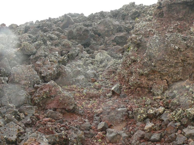
In about 15 miles we reached the air strip out there and turned off the Kimama-Carry road and headed North East about 10 more miles to enter Laidlaw Park by driving over a lava flow. This flow is about 7500 years old. More driving now inside Laidlaw and also now in the Craters of the Moon Monument proper. Heading north. More rain, not heavy but pretty constant. I am not worried, yet.
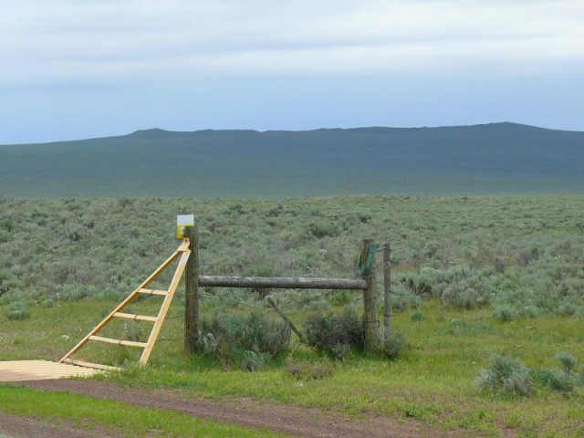
About twenty miles we get to
Cattle guard.
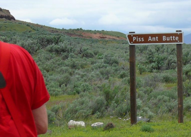
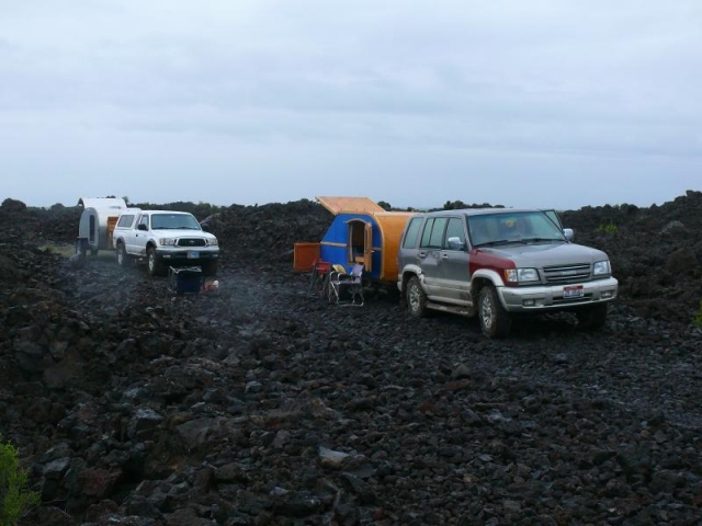
Brad's pickup and my trailer at Piss Ant Butte
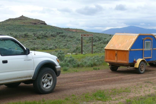
We then drove up to the butte and discover that is a place the red volcanic cinders was sourced from for the roads. One reason they have been so good.
From there we kept heading North another 10 or so miles to Snow Drift Crater, There is an aspen grove in it. Would have been a great view of the Sawtooth Mountains but that pesky rain is still with us.
Head out from there heading west and south now towards the west end of the Mordor Road as I call it. We did see some large game here.
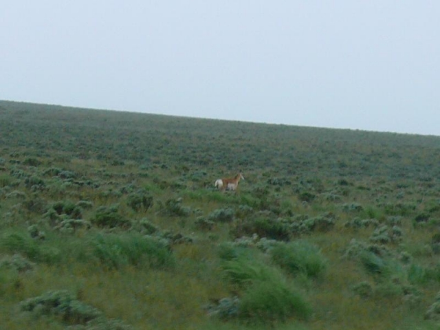
They was moving pretty good. About 6 of them. I got this photo by wide angle lens and shooting while driving. Oh, we did see cows out there. Did not bother with pics.
We get down on the road that runs along the west side of the lava flow that is the goal for the day. I am looking for the road up on the flow but it was not as I remembered it from when I came this way about 7- 8 years ago. We dive past one seldom used spur and about 3 mile on I decide we has gone to far. With Brad's GPS giving up coordinates and the maps from the Park service decide that spur was the road I wanted. We turn around and get back on track and come to the Morodor Road. Still raining, has not really stopped for some time. I start up the incline of dirt that has been hauled in to get up on the flow and I sink in. I been running in AW so I put it in 4x4 low range. Dirt is kind of a clay and as it has been hauled in is unconsolidated. Which means MUD. Vehicle sinks down and wheels spinning. Hope that I do not slip sideways and into the ravines. I go forward, stop, back up a bit and then go forward some more. It sinks down and seems to hit rocks to get traction and I go forward. Can't go back now as no way to steer the trailer so keep heading forward. In a few moments I get off the mud. Brad comes up and says after I made a mess of the once smooth surface he did not have much trouble. We drove almost 1/2 mile on the Morodor Road and I stopped to make camp. As I was hopping out of my Trooper I look a few feet off the road and I swear I see a trail. I explored it a bit and I am convinced it is an old indian trail. I had heard there are some out here but I did not imagine they were on this flow. I explored it some and even more convinced it is an old trial.
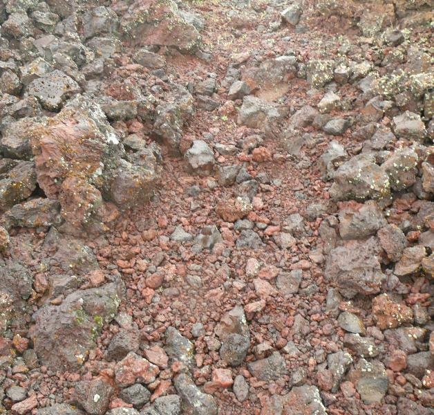
Can see large rocks have been moved aside and little rocks have been placed in the trail.
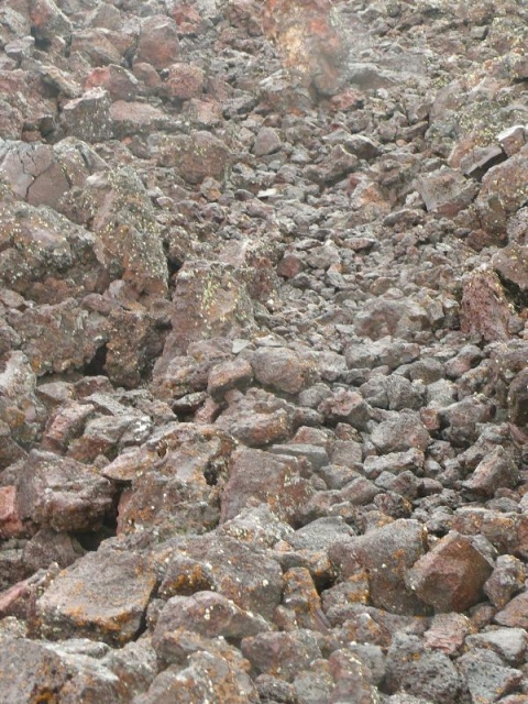
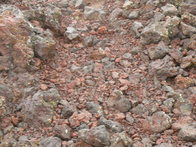
Small red lava chunks in trail.
Large chunk of red lava on side of trail. Looks to me it has been broken up to supply the small red chunks.
It looks to me like a trail. When I got home I looked at the area on satellite photos and found there are at least 3 other pieces of the trail not destroyed by the road. Then looking a bit north of the road I see a branch off of this trail. Then a bit further there is another complete trail.
Well we settle down to camp in the rain. At least there is no mud, as there is no dirt.
Camping in the rain, Just camping it the rain.
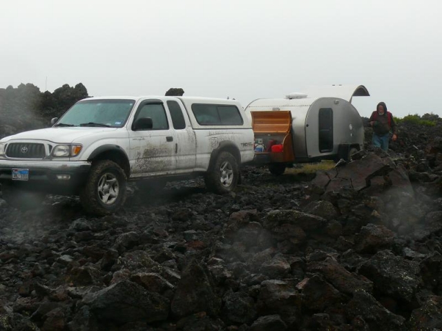
Brad's rig a bit dirtier than when we began.
We had a good camp fire, swapped stories. Night was quiet, no body else out there.
Got up the next morning and got moving again about 9 ish. I was a bit worried about the dirt ramp getting off the flow but at least we have gravity on our side. Other than a gate up at the east end did not have any trouble. We got off the Mordor Road and started driving and driving again. Rain had started up again while we was eating breakfast. Now raining a bit harder. Desert was so green this year. Green desert, black lava and gray skies was prominent colors. Now driving south along the lava flow to get round the south end and a bit west.
I am now sinking a bit into the road and some side slip. After about ten miles I stop at a cross road we passed the day before. I talked with Brad. I had decided we had better get out of there, now. He did not disagree. Closest way out would be to Carry Idaho. First nine miles back to Piss Ant Butte and then west. Road to Piss Ant was soft, much softer than the day before. West of there was soft for about 10 miles before we began to get to better built/maintained roads. 10 more miles or so we start to get into farm land again and real county gravel road. We stop there for a bit.
It has been 26 hours since we saw any one driving. And about 90 miles of gravel/dirt/mud roads. We get into Carry and fuel up, muddy roads suck down millage. Stopped for a hamburger at a little restaurant. Still raining. Raining pretty good really. We said good bye and I headed home and Brad went to the head quarters of the Monument.
Rained most of the way home. At home I had almost an inch of rain and it looked much drier there. The guy I work for says he measured almost 2 inches. That is a lot.
Well that was the Mordor Expedition. A few days after it as over I remembered I kidded Grant Whip a bit when he said no one else was permitted to use the name "The Dam Gathering" as he was retiring from running that meet. I asked him if "The Damp Gathering" fair game. He said I could have it. So "The Damp Gathering" is alive and well.


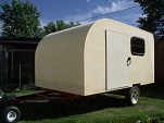
 Maybe someday...